History
Charwelton was selected around 1946 to provide a repeater station for the London to Birmingham televison link, operating on 900 MHz. The station is included on the 1956 "Backbone" map showing the TV route to Birmingham and other links to sites at "Coalville" and "Tring". These correspond to Copt Oak and Stokenchurch respectively in the network which was eventually developed. The site code YBFM may reflect an earlier name "Blackdown Farm" which appears on a 1948 diagram of the Control Circuit (a 4-wire telephone cable) for the original TV link.
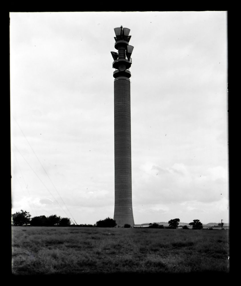
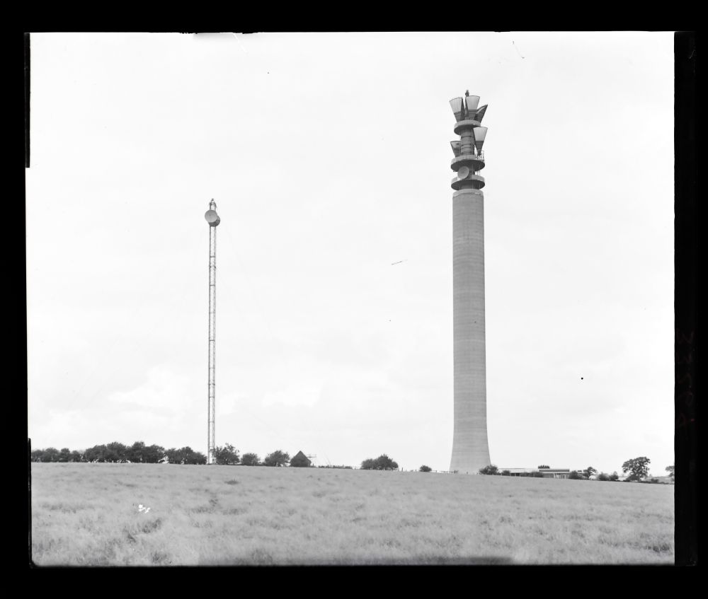
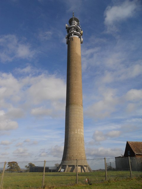
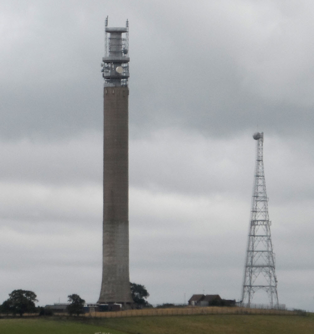
As with the other 900 MHz sites the first provision was a guyed mast and later a small square tower but at Charwelton the 1960s development was a concrete tower of the "Chilterns" design. The original television link was routed via Turners Hill (initially planned as the end of the radio link, continuing via cable) however there is line of sight between Charwelton and Birmingham and subsequent links bypassed Turners Hill. A 1955 OS map shows "mast" and "Television Relay Station - a 1980 plan at 1:2500 scale shows two small buildings south of the tower - these are from the original 1949 link and were still standing in 2016. (Another steel tower, south of the BT compound, is believed to have been part of the national gas communications network, probably addded in the late 1960s.)
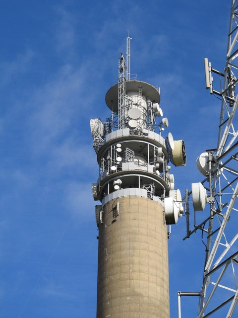
The concrete tower appears strucurally complete during 1964 and had been equipped with horn antennas by early 1965. At this point a guyed mast carried dishes for the London to Birmingham route but there was no trace of the tower which would have been installed around 1950 for the 900 MHz link (see Dunstable for more details). The new tower was provided with pairs of horns for the established route and single horns for the Stokenchurch to Copt Oak "Backbone" links. A subsequent change in frequency allocation meant the addition of dishes facing Stokenchurch and Copt Oak - the horns facing these sites were subsequently removed.
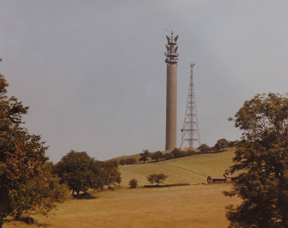
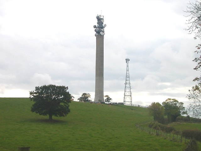
Charwelton's location at the intersection of the London - Birmingham and Stokenchurch - Copt Oak links resulted in a "busy" site eventually having many dishes facing in each direction, though concentrated primarily on the London/Birmingham route. Although some "pruning" had occurred by 2009 a number of large dishes still remained in position as late as 2011.
BT Archives has reports of an experimental 11 GHz link between Charwelton and Dunstable being in operation by 1974 and the use of "phase control height diversity" to overcome long-term fading which was experienced. (The distances between Birmingham, Charwelon and Dunstable were longer than average within the network.)
The top of the structure was modified - the central section above the highest antena "gallery", with built-in crane, was removed. This may have been a consequence of an incident in September 1984 where an RAF Jaguar (XX977) struck the tower "380 ft from its base" - the pilot made an emergency landing at Bedford. A planning application in 1986 "Alteration to Existing Radio Tower" may be related.